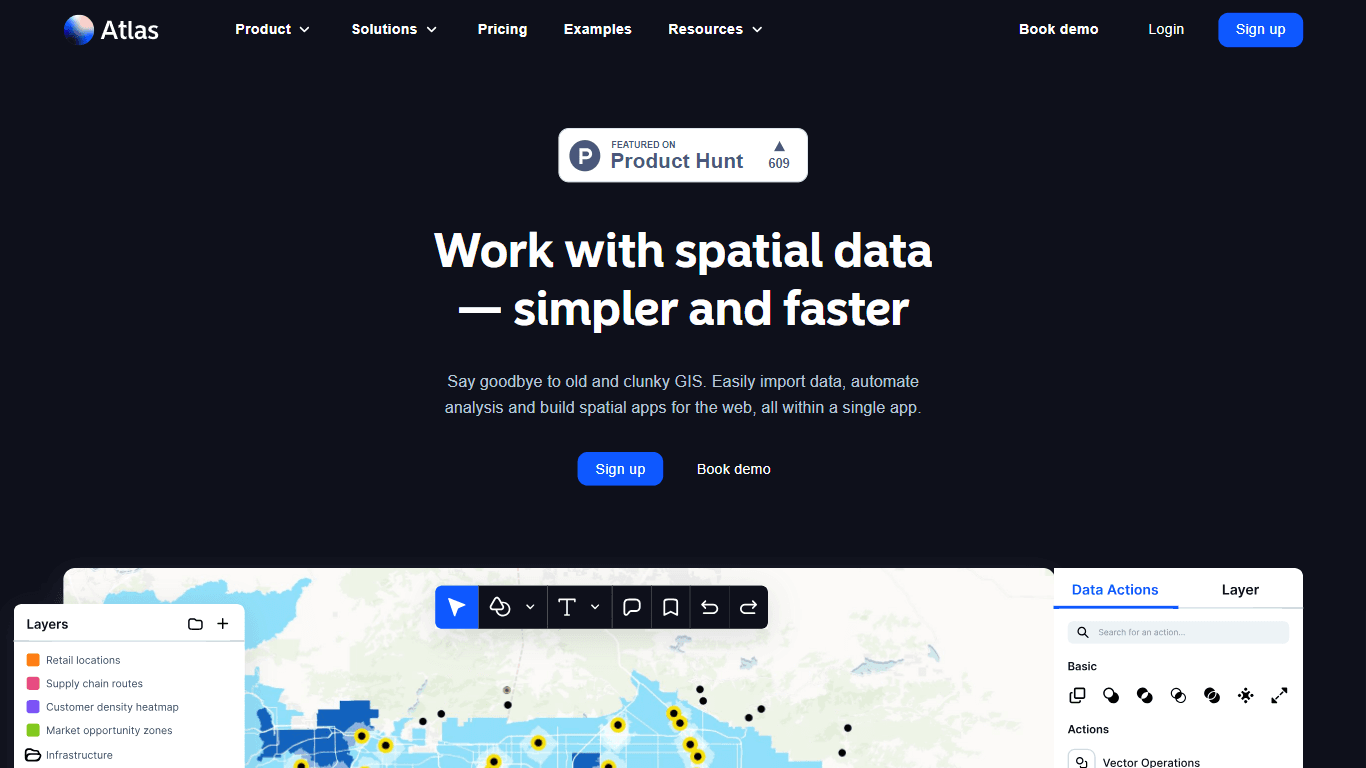
Atlas.co
Atlas is a browser-based Geographic Information System (GIS) platform designed to simplify the visualization and analysis of spatial data. It enables users to import various data formats, automate com
12,150
Votes
23,588
Views
7,215
Bookmarks
About
Atlas is a browser-based Geographic Information System (GIS) platform designed to simplify the visualization and analysis of spatial data. It enables users to import various data formats, automate complex analyses, and build spatial applications seamlessly within a single interface. The platform caters to a diverse audience, including sales teams, marketing agencies, operations teams, and enterprises of all sizes, making it an essential tool for anyone who relies on location data for decision-making. The unique value proposition of Atlas lies in its user-friendly design, which allows individuals without prior GIS expertise to perform advanced spatial analyses. By providing access to over 20 supported file formats and integration with open data sources like OpenStreetMap, Atlas empowers users to enrich their datasets and derive meaningful insights. Key differentiators include its collaborative workspaces, which facilitate cross-functional teamwork, and its extensive library of analytical tools that cater to both beginners and experts alike. Atlas is particularly beneficial for industries such as retail, real estate, and energy, where location-based data plays a critical role in strategic planning and operational efficiency. The platform's ability to streamline the mapping process and enhance data visualization makes it a valuable asset for organizations looking to leverage geospatial data effectively.
Key Features
- Multi-Format Data Import: Supports over 20 file formats including CSV, GeoJSON, KML, and Shapefile, allowing users to easily import diverse datasets into the platform.
- Open Data Integration: Enables users to query and enrich datasets using open sources like OpenStreetMap and Overture, enhancing the quality and depth of spatial analyses.
- Advanced Spatial Analysis Tools: Offers a suite of over 50 analytical tools that simplify complex GIS tasks, making advanced analysis accessible to users without prior expertise.
- Collaborative Workspaces: Facilitates teamwork by allowing users to create and manage multiple workspaces for projects, files, and resources, promoting cross-functional collaboration.
- Public Sharing Options: Projects are private by default but can be shared publicly, enabling users to gather feedback and engage with stakeholders effectively.
FAQ
What types of data can I import into Atlas?
Atlas supports over 20 file formats for data import, including CSV, GeoJSON, KML, and Shapefile, making it versatile for various data sources.
Is prior GIS knowledge required to use Atlas?
No, Atlas is designed to be user-friendly, allowing individuals without prior GIS expertise to perform advanced spatial analyses easily.
Can I collaborate with my team on Atlas projects?
Yes, Atlas provides collaborative workspaces where team members can share projects, files, and resources, facilitating effective teamwork.
What industries benefit from using Atlas?
Atlas is utilized across various industries, including retail, real estate, and energy, where location data is crucial for decision-making.
How can I share my Atlas projects with others?
Projects in Atlas are private by default but can be shared publicly through links, allowing for feedback and engagement with external stakeholders.
What support options are available for Atlas users?
Atlas offers support via email during business hours, Monday through Friday, excluding company holidays. Live chat and phone support are not available.
You may also like
More tools in Data & Analytics

Supametas.AI
A tool to transform unstructured data into structured formats for AI models and knowledge bases.
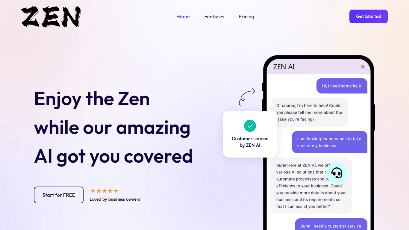
ZEN AI
Discover unparalleled customer service with ZEN AI, an intelligent customer support assistant designed for businesses of all sizes. ZEN AI operates around the clock, ensuring that your customers alway
Align AI
Streamlines AI strategy alignment with business objectives.

AICosts.ai
A tool to centralize tracking and optimization of spending across multiple AI services.

Tagshop AI
A tool to generate video ads from prompts and assets.
InstaSpeak
InstaSpeak is an innovative AI-powered Learning Management System designed specifically for enhancing spoken English skills. It provides a unique platform that integrates effortlessly with your Englis

Qoder
Enhance coding efficiency with AI-driven insights.
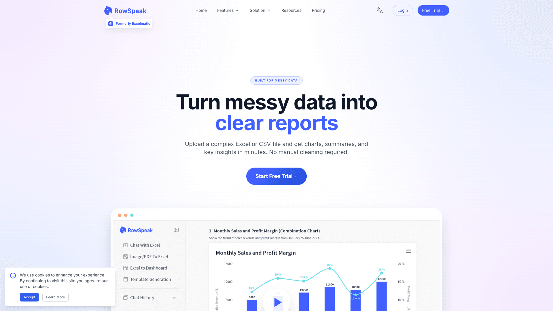
RowSpeak
Turn messy spreadsheets into clear, ready reports.

Help Docs Generator
A tool to generate customer support help docs from SaaS product screenshots.
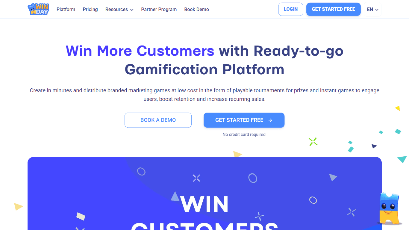
Winday
Winday is a no-code gamification platform that helps brands and creators design and launch branded marketing games quickly. It supports two main game types: Instant Games for quick coupon distribution

ZeroGPT
ZeroGPT.com stands out as the premier destination for AI detection, setting the gold standard in safeguarding digital landscapes. With cutting-edge algorithms and advanced machine learning models, Zer
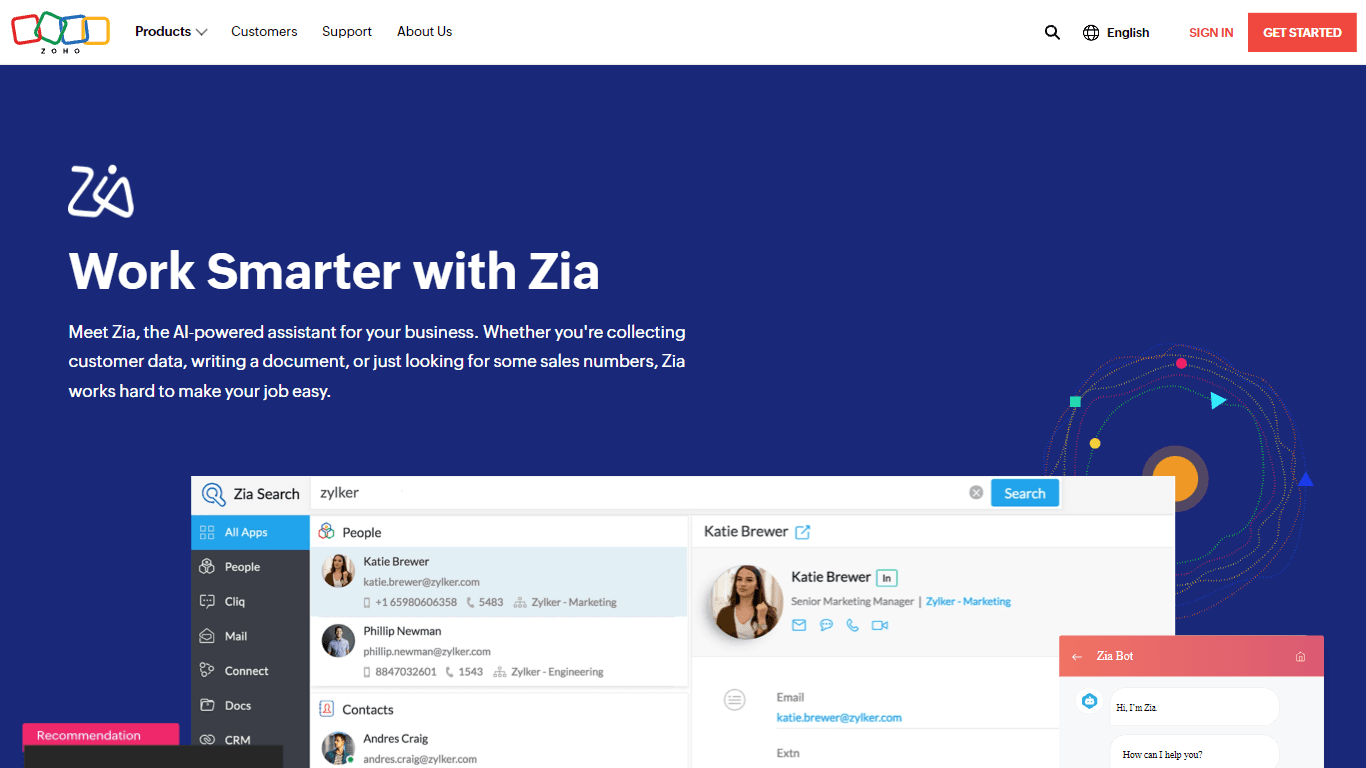
Zia
Maximize your business efficiency with Zia, Zoho's advanced AI assistant designed to streamline your business operations across various functions. Zia acts as a dynamic tool, providing tailored recomm